EUR

FR   EN   中文

CONNECTION
Topographical map of Jerusalem
Topographical map of Jerusalem - Curiosities Style Topographical map of Jerusalem - Topographical map of Jerusalem - Antiquités - Topographical map of Jerusalem
Ref : 114501
8 200 €
Period :
20th century
Provenance :
France
Medium :
Papier mâché, plaster, paint, wood
Dimensions :
l. 16.93 inch X H. 4.13 inch X P. 22.83 inch
Curiosities  - Topographical map of Jerusalem 20th century - Topographical map of Jerusalem  - Topographical map of Jerusalem Antiquités - Topographical map of Jerusalem
Desmet Galerie

Classical Sculpture


+32 (0)486 02 16 09
Topographical map of Jerusalem

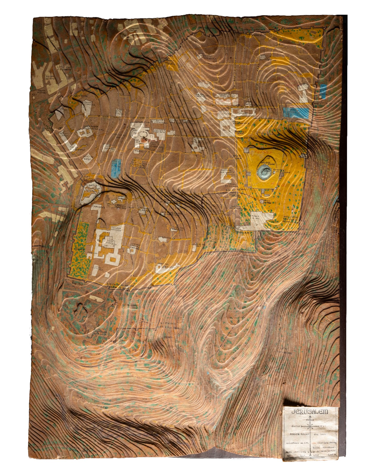
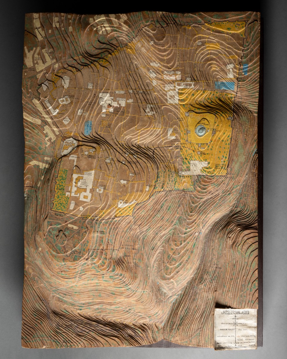
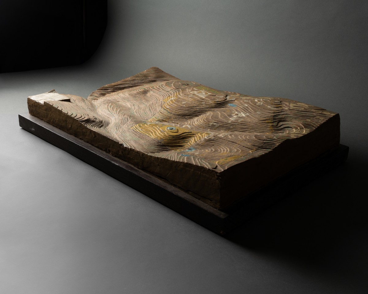
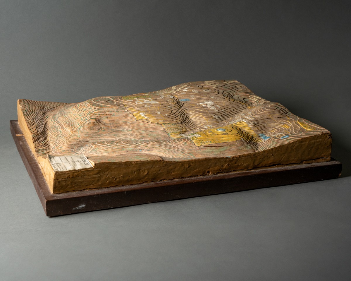
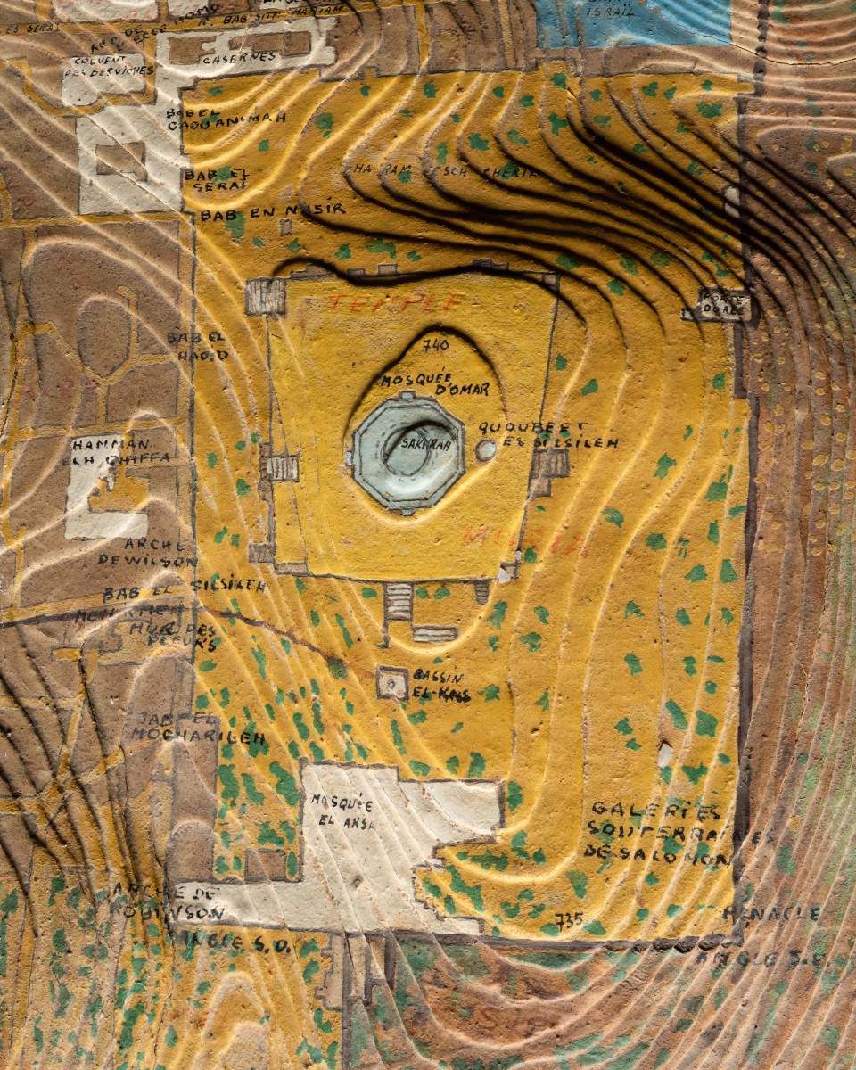
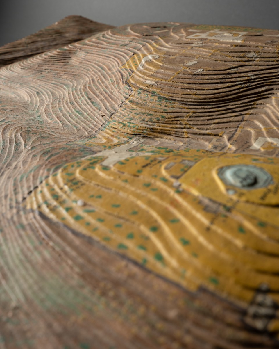
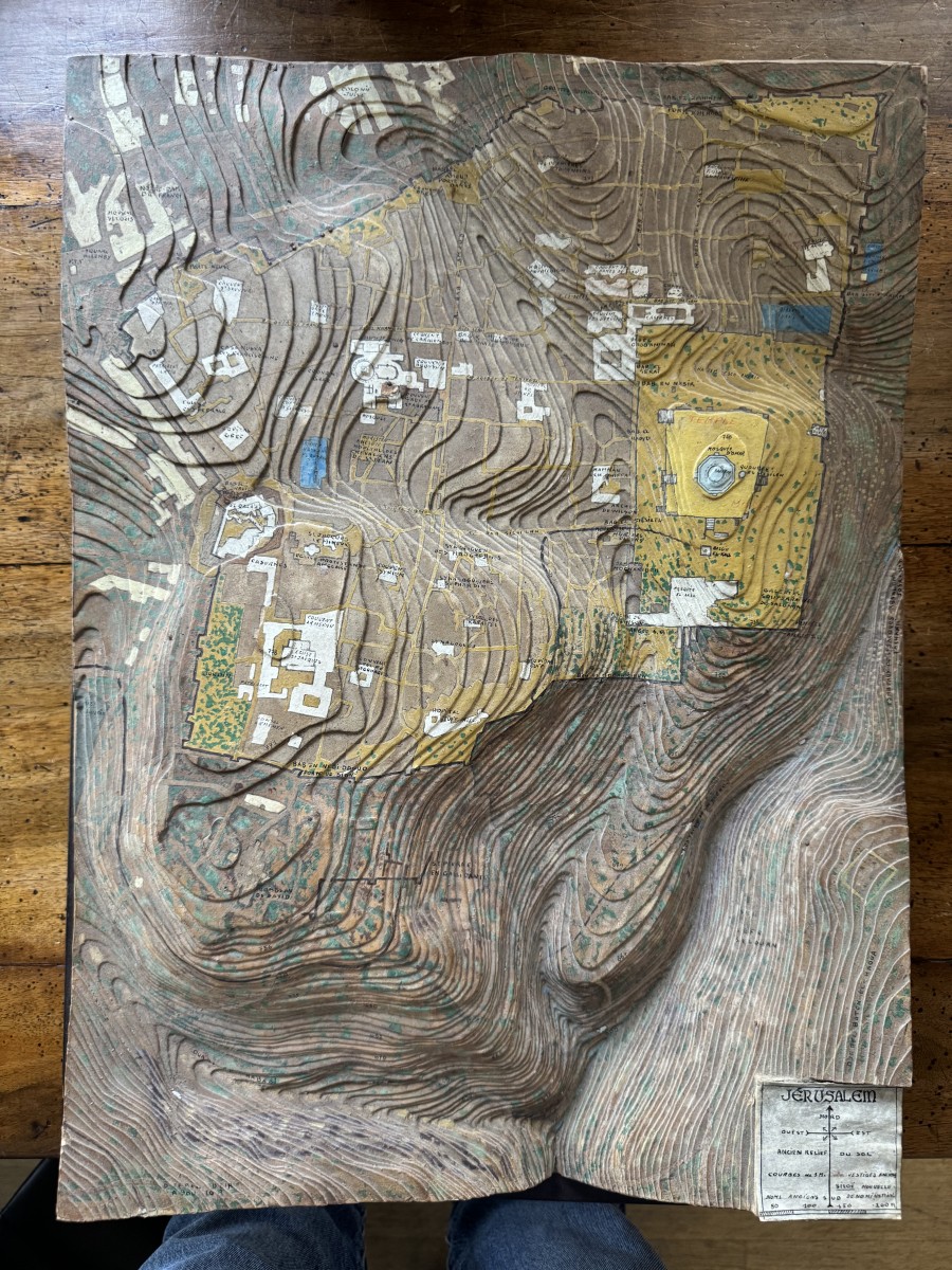
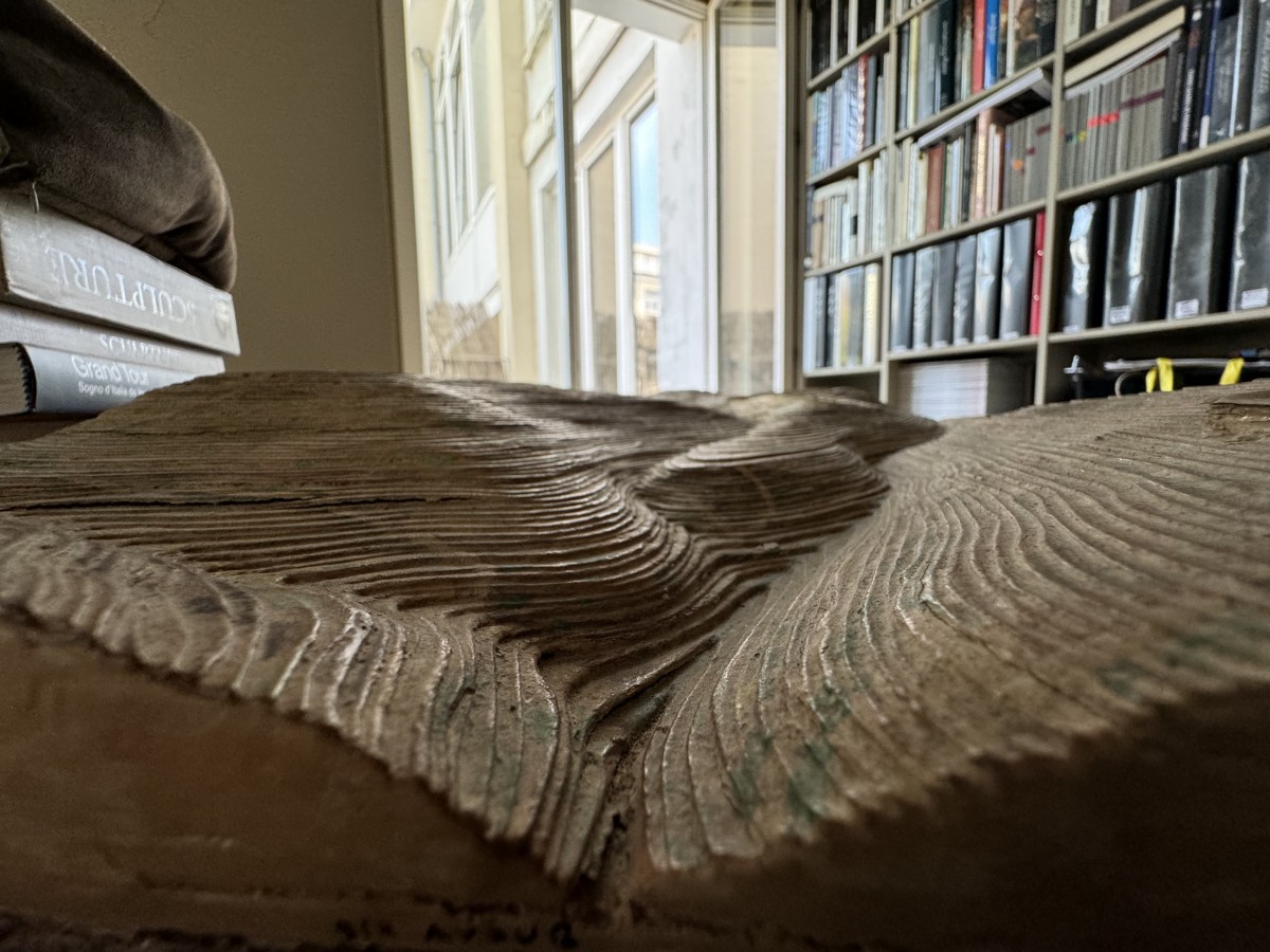
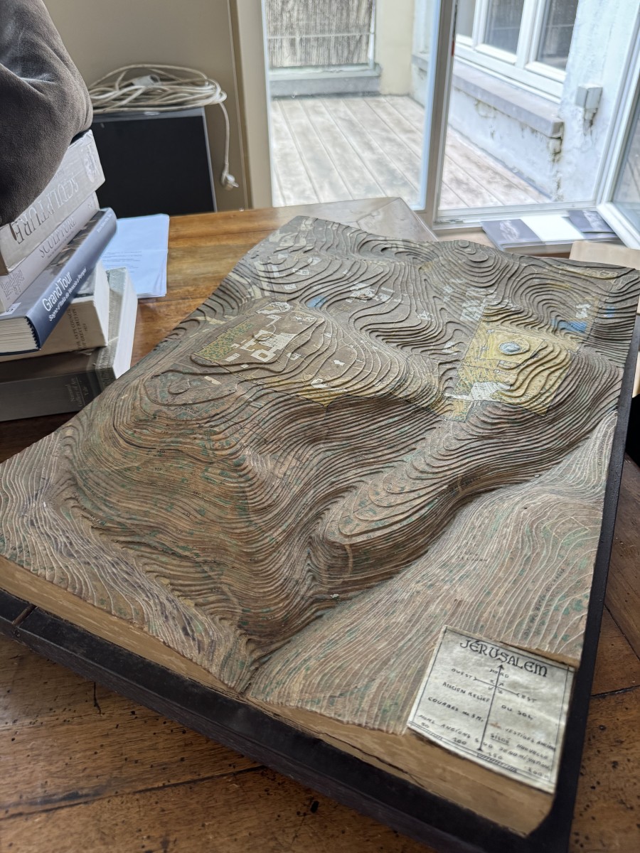
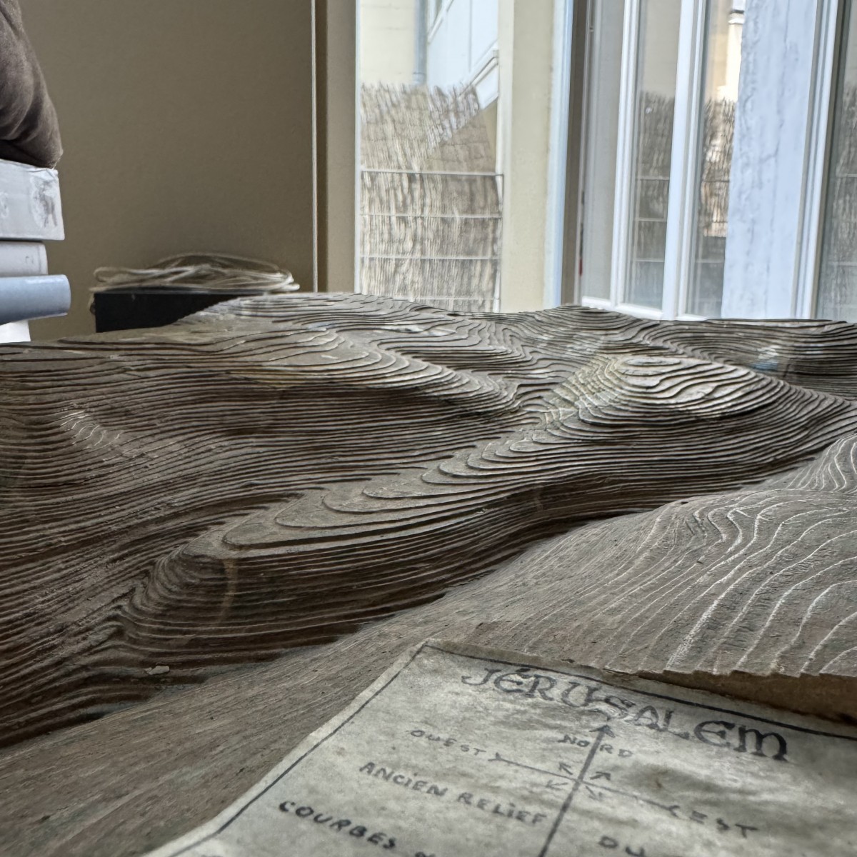
Topographical map of Jerusalem,
French, circa 1920

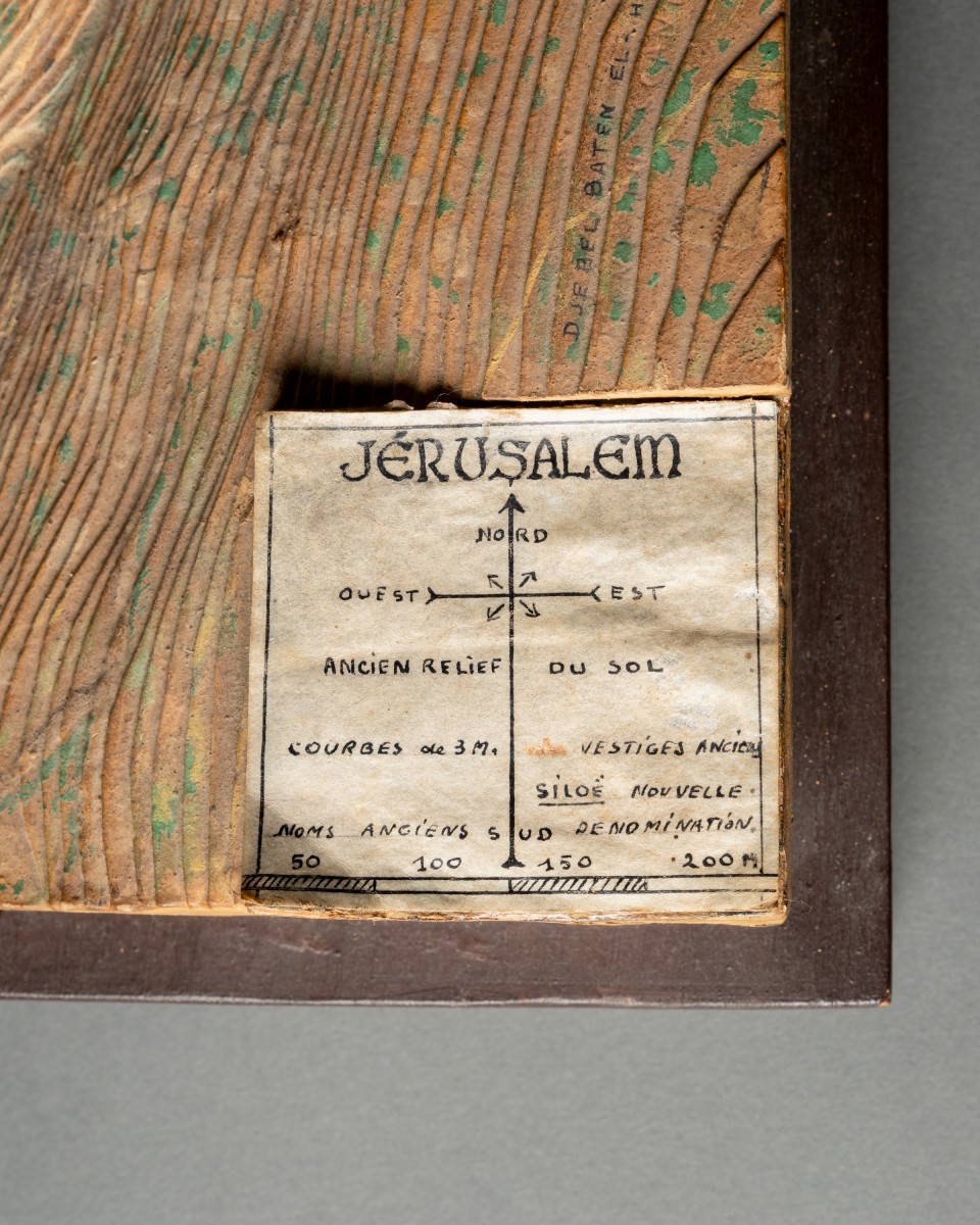
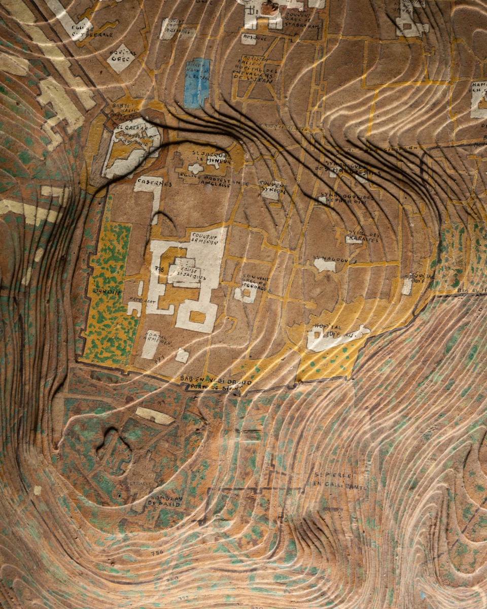
Wood and hand-coloured plaster / papier machete, showing a plan of the Biblical city, annotated showing the key features and contours of the surrounding landscape, with a compass and a scale lower right

58 x 43 x 10,5 cm
22 7/8 x 17 x 4 1/8 inch

Delevery information :

We can arrange shipping.

Desmet Galerie

19th century
Marble Owl, 19th century Italian School

16 000 €

19th century
Apollino

58 000 €

CATALOGUE

Curiosities